


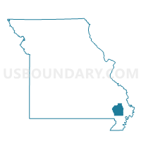
Vinson Voting District, Stoddard County, Missouri
About
Outline

Summary
| Unique Area Identifier | 611411 |
| Name | Vinson Voting District |
| County | Stoddard County |
| State | Missouri |
| Area (square miles) | 108.70 |
| Land Area (square miles) | 108.37 |
| Water Area (square miles) | 0.33 |
| % of Land Area | 99.70 |
| % of Water Area | 0.30 |
| Latitude of the Internal Point | 36.69347830 |
| Longtitude of the Internal Point | -89.81787140 |
Maps


Graphs
Select a template below for downloading or customizing gragh for Vinson Voting District, Stoddard County, Missouri


Neighbors
Neighoring Voting District (by Name) Neighboring Voting District on the Map
- Bernie Rural Voting District, Stoddard County, MO
- COMO 1 Voting District, New Madrid County, MO
- COMO 2 Voting District, New Madrid County, MO
- COMO 5 Voting District, New Madrid County, MO
- Dexter Rural Voting District, Stoddard County, MO
- Essex Voting District, Stoddard County, MO
- Gray Ridge Voting District, Stoddard County, MO
- LEWIS 1 Voting District, New Madrid County, MO
- NEW MADRID 4 Voting District, New Madrid County, MO
- WEST 3 Voting District, New Madrid County, MO
- WEST 4 Voting District, New Madrid County, MO
Top 10 Neighboring County Subdivision (by Population) Neighboring County Subdivision on the Map
- Liberty township, Stoddard County, MO (14,738)
- New Madrid township, New Madrid County, MO (3,778)
- Lewis township, New Madrid County, MO (1,802)
- Como township, New Madrid County, MO (1,674)
- West township, New Madrid County, MO (1,592)
- Richland township, Stoddard County, MO (1,414)
- Elk township, Stoddard County, MO (354)
Top 10 Neighboring Unified School District (by Population) Neighboring Unified School District on the Map
- Dexter R-XI School District, MO (12,958)
- New Madrid County R-I School District, MO (9,385)
- Bernie School District, MO (3,151)
- Richland R-I School District, MO (1,542)
Top 10 Neighboring State Legislative District Lower Chamber (by Population) Neighboring State Legislative District Lower Chamber on the Map
- State House District 159, MO (35,685)
- State House District 161, MO (34,576)
- State House District 163, MO (33,118)
- State House District 162, MO (31,602)
Top 10 Neighboring State Legislative District Upper Chamber (by Population) Neighboring State Legislative District Upper Chamber on the Map
Top 10 Neighboring 111th Congressional District (by Population) Neighboring 111th Congressional District on the Map
Top 10 Neighboring Census Tract (by Population) Neighboring Census Tract on the Map
- Census Tract 9601, New Madrid County, MO (4,565)
- Census Tract 4704, Stoddard County, MO (3,102)
- Census Tract 4707, Stoddard County, MO (2,724)
- Census Tract 9605, New Madrid County, MO (2,583)
- Census Tract 9604, New Madrid County, MO (2,503)
- Census Tract 9602, New Madrid County, MO (2,375)
Top 10 Neighboring 5-Digit ZIP Code Tabulation Area (by Population) Neighboring 5-Digit ZIP Code Tabulation Area on the Map
- 63801, MO (23,123)
- 63841, MO (13,123)
- 63822, MO (2,867)
- 63846, MO (1,554)
- 63870, MO (1,097)
- 63828, MO (345)
- 63833, MO (242)